.jpg)

HanseNautic - Ihr Partner für Seekarten, Yachtelektronik und Bootszubehör


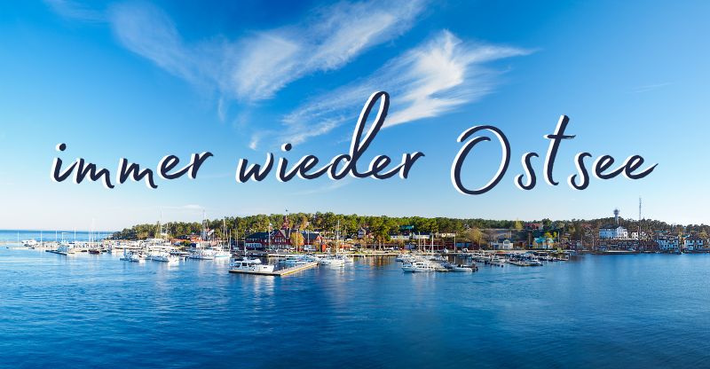
Immer wieder Ostsee! Das Mare Balticum begeistert Menschen seit jeher und steht für Erholung wie Abenteuer. Erleben Sie mit uns die Vielseitigkeit dieses einmaligen Gewässers, den Zauber der Ostsee entlang historischer Fischerdörfer, pulsierender Metropolen und eine faszinierende Inselwelt.
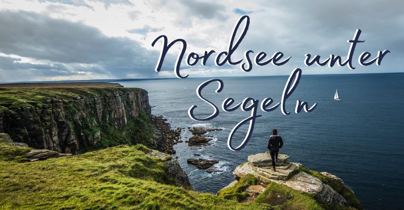
Nordsee unter Segeln! Tosende Wellen und salzige Gischt - die Nordsee zählt mit ihren über 350 Millionen Jahren zu einem der ältesten Meere und ist ein Sehnsuchtsort für viele Wassersportler. Das Revier besticht mit seinen abwechslungsreichen Inseln, dem Watt und seiner schier unendlichen Weite.


Unsere Topseller & Angebote
Alle Angebote anzeigen


")

")


Blog
Alle BeiträgeHansenautic News

Jetzt sparen: Cashback bei B&G und Simrad Kartenplottern

NV Atlas Binnenband 5 - Der Neue im NV Charts Binnenteam

Motor einwintern

Schiff einwintern - wohin mit dem Boot
Yachtelektronik - neu eingetroffen

")


Bootsausrüstung - unsere Highlights


, klappbar")

")
")
, klappbar")

")
")


Bücher - Unterhaltungsliteratur - Führerscheine

Endlich: Lesen an Bord! Dem Lärm der Stadt und des Alltags entfliehen. Bei uns finden Sie Literatur zu allen Themen - vom eigenen Refit bis zur Umrundung der Welt. Entdecken Sie aber auch leichte und heitere Geschichten für Hafentage oder leereiches für die kalte Jahreszeit. Bei unserer breiten Auswahl an Bestsellern und Neuerscheinungen der nautischen Literatur müssen Sie nur noch eins aussuchen.
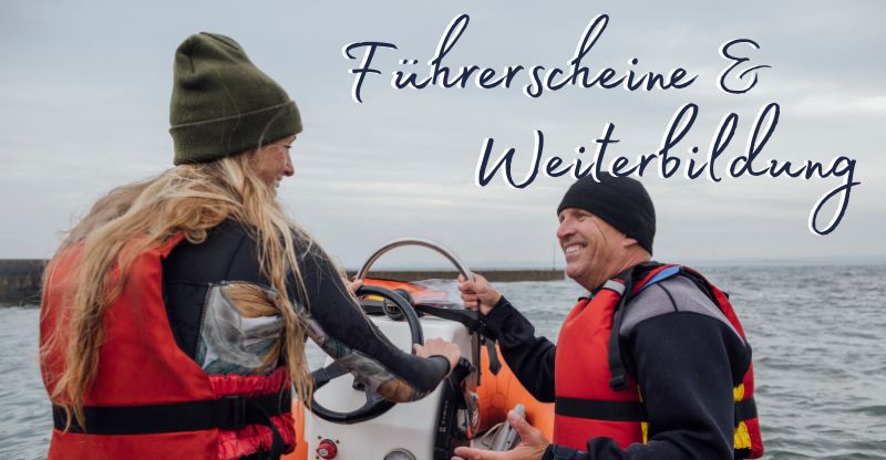
Segeln lernen aber richtig! Segeln kann ein großartiges Abenteuer sein und ermöglicht die Natur und das Meer auf eine einzigartige und aufregende Weise zu erleben. Man kann die Freiheit spüren, wenn der Wind in den Segeln weht und das Boot über die Wellen gleitet. Damit Sie gut gerüstet sind für Ihre Zeit auf dem Wasser, bieten wir Ihnen viele Schulungs- und Prüfungsunterlagen für die verschiedenen Führerscheine.


 aller Ostseefischer")


HanseNautic - über uns
Seekarten & Bootszubehör
HanseNautic ist Deutschlands Komplettanbieter für Seekarten und Bootszubehör aller Art.
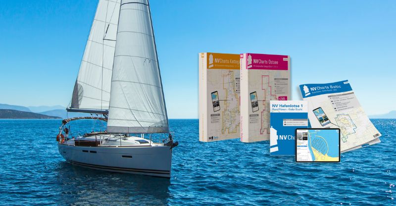
Papierseekarten – mehr als nur verpflichtendes Backup!
Ob Jolle oder Yacht, Wassersportler oder Berufsschiffer – eine Seekarte aus Papier an Bord zu haben ist in den meisten Ländern der Welt obligatorisch. HanseNautic hat sich auf Papierseekarten für Freizeitsportler spezialisiert. Im Vergleich zur Berufsschifffahrt, die allein die amtlichen Karten von hydrografischen Ämtern wie BSH und UKHO verwenden dürfen, sind diese Seekarten außerhalb der Fahrwasser und in den Häfen deutlich detaillierter. Zu den beliebtesten Revieren zählen neben der Ostsee – mit der atemberaubenden Dänischen Südsee – auch die raue Nordsee. Das Wattenmeer beispielsweise ist eine anspruchsvolle Schönheit: wer ihr nicht mit Respekt begegnet, wird rasch eines Besseren belehrt. Die Gezeiten wollen stets eingeplant, das sich rasend schnell ändernde Wetter immer im Blick behalten sein. Das Sehnsuchtsziel Kroatien hingegen kann auch ein Segeleinsteiger ansteuern – und findet sich mit dem passenden Kartensatz schnell und intuitiv zurecht.
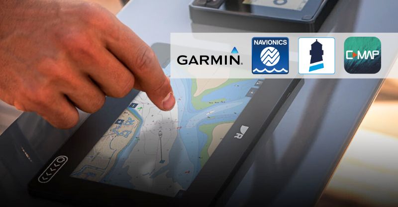
Elektronische Navigation neu erleben
Neben den klassischen Papierseekarten nehmen digitale Seekarten auch im Freizeitsport einen immer höheren Stellenwert ein. HanseNautic hat mit seinem breitgefächerten Portfolio für jeden etwas im Angebot. Je nach Hardware haben Sie die Wahl zwischen Plotterkarten von Navionics, C-MAP, NV Charts oder beispielsweise Garmin BlueChart. Jeder Hersteller setzt auf andere Vorzüge bei seinen elektronischen Seekarten. Navionics punktet mit erstklassigen Vektorkarten, die eine hohe Nutzerfreundlichkeit und 1a-Qualität in den Fokus stellen. Unschlagbar in seiner Kompatibilität ist hingegen C-MAP. Fast jeder gängige Kartenplotter kann die Speicherkarten des Herstellers auslesen. Außerdem ist C-MAP unübertroffen in der beinahe weltweiten Abdeckung der Seeschifffahrtsreviere. Die neuen C-MAP Reveal X und Discover X Seekarten begeistern mit innovativen Funktionen wie der 3D-Ansicht durch Schatten-Reliefs.
Mit Törnführern schon vor dem Urlaub auf die Route einstimmen
Früher als Hafenhandbuch bezeichnet, setzte sich nach und nach der Begriff Törnführer durch. Diese handlichen Guides gehören zur Lieblingslektüre auf See – oder machen noch zuhause und während der Vorbereitungen auf den Urlaub Lust auf Mee(h)r. Unsere Törnführer erkunden akribisch Hafen um Hafen eines bestimmten Revieres. Ankerplätze und Marinas werden dabei anhand eines Luftbildes, eines Hafenplans oder einer Beschreibung vorgestellt. Wer ein Hafenhandbuch Ostsee sucht, kann bei HanseNautic in einer großen Auswahl stöbern. Außer den Zufahrtsplänen für die unterschiedlichen Häfen, gibt es in den Büchern reichlich Tipps zu nahegelegenen Ausflugszielen und kulinarischen Highlights oder regionalen Besonderheiten. Ein Dauerbrenner der letzten Jahre sind die Törnführer Kroatien. Die Adria lockt Segler und Motorbootfahrer gleichermaßen mit abwechslungsreicher Küste, kristallklarem Wasser und angenehmen Temperaturen.
Yachtelektronik – Kompetent beraten von Wassersportlern aus Leidenschaft
Neben nautischen Publikationen und digitalen Seekarten, ist HanseNautic einer der führenden Onlineshops für Yachtelektronik und Bootszubehör. Ob Kartenplotter von Raymarine oder Sportuhren von Garmin – hier kommen Regattasegler und Sportbootfahrer gleichermaßen auf ihre Kosten. Plotter von Simrad sind zu Recht ein weiterer Verkaufsschlager. Die Multifunktionsdisplays lassen sich intuitiv bedienen und bieten mit speziellen Sonardisplays Sportfischern und Hobbyanglern die Chance auf den großen Fang.
Für Sportschiffe unter 20m nicht vorgeschrieben aber ein großes Plus für die Sicherheit auf dem Wasser sind Seefunkgeräte und AIS-Transponder. Aufgepasst: wenn Ihr Boot mit einem Funkgerät ausgestattet ist, müssen Sie oder zumindest ein Anwesender an Bord ein Funkzeugnis besitzen und die Aufgabe als Funker übernehmen. Ein AIS-Gerät (AIS steht für Automatic Identification System) dient vorwiegend der Kollisionsverhütung. Es sendet und empfängt statische, dynamische und reisebezogene Schiffsdaten.
Keine Kompromisse: Sicherheitsausrüstung auf höchstem Niveau
Wenn es doch zum Ernstfall kommt und Sie Ihr Schiff verlassen müssen, sollten Sie perfekt ausgerüstet sein. Im Gegensatz zu Rettungswesten, ist das Mitführen von Rettungsinseln auf deutschen Sportbooten nicht vorgeschrieben. Je nach Größe des Schiffes und Fahrtgebiet werden sie jedoch dringend empfohlen. Bei einer Wassertemperatur von 10°Celcius kann ein Erwachsener mit Schwimmweste und voller Bekleidung etwa zwei Stunden überleben. Das größte Problem ist das Auskühlen des Körpers. Eine Rettungsinsel vergrößert die Überlebenschancen erheblich.