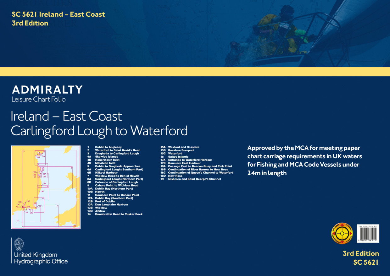
SC5621 Ireland - East Coast, Carlingford Lough to Waterford
Beschreibung
Kartensatz wurde eingezogen, Einzelblätter sind im Print-on-Demand Verfahren erhältlich - bei Interesse kontaktieren Sie uns gerne!
Kartensatz wurde eingezogen, Einzelblätter sind im Print-on-Demand Verfahren erhältlich - bei Interesse kontaktieren Sie uns gerne!
ADMIRALTY SC5621 - Ireland East Coast, Carlingford Lough to Waterford - ist ein amtlicher Sportbootkartensatz für die Küste Irlands zur Irischen See von der Grenze zu Nordirland bis zum Fluss Barrow an der Südküste.
Der Kartensatz ist für die Sportschifffahrt konzipiert und ist zusätzlich von der britischen Maritime and Coastguard Agency (MCA) für ausrüstungspflichtige Schiffe bis 24m Länge zugelassen.
Abdeckung und Kartenliste:
Der Satz SC5621 enthält unter anderem die Seekarten für die Ansteuerungen in die Häfen von Dublin, Wexford, Arklow, Dun Loghaire und Poolbeg Marina.
Im einzelnen sind folgende Karten enthalten:
Übersegler
19. Irish Sea and St. Georges Channel - 1:500.000
1. Dublin to Anglesey - 1:200.000
2. St George's Channel - 1:200.000
Revierkarten
3. Drogheda to Carlingford Lough - 1:100.000
5. Dublin to Drogheda - 1:100.000
7. Ben of Howth to Wicklow Head - 1:100.000
9. Wicklow Head to Cahore Point - 1:100.000
11. Cahore Point to Carnsore Point - 1:100.000
14. Tusker Rock to Dunabraitin Head - 1:150.000
Details
4A. Skerries Islands - 1:12.500
4B. Rogerstown Inlet - 1:20.000
4C. Malahide Inlet - 1:10.000
6A. Carlingford Lough(S part)- 1:20.000
6B. Kilkeel Harbour - 1:5.000
8A. Carlingford Lough- 1:20.000
8B. Ent. to Carlingford Lough - 1:12.500
10A. Dublin Bay (N Part)- 1:25.000
10B. Howth - 1:7.500
12A. Dublin Bay (S part)- 1:25.000
12B. Port of Dublin - 1:7.500
13. Harbours on the East Coast of Ireland
15A. Wexford and Rosslare - 1:30.000
15B. Rosslare Europort - 1:10.000
15C. Waterford - 1:7.500
16. Saltee Islands- 1:25.000
17A. Entrance to Waterford Harbour - 1:25.000
17B. Dunmore E Harbour 1:5,000
18A. Passage E to Beacon Quay and Pink Point
18B. Cont. of River Barrow to New Ross,
18C. Cont. of Queens Channel to Waterford
18D. New Ross
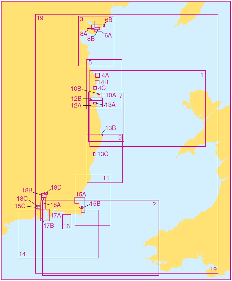
Mit Hilfe unserer Gebietsvorschau erhalten Sie einen Eindruck davon, mit welcher geografischen Region sich das Produkt auseinandersetzt oder welche Gebiete eine Seekarte abdeckt.
Bewertungen
Anmelden


