Zum Hauptinhalt springen Zur Suche springen Zur Hauptnavigation springen

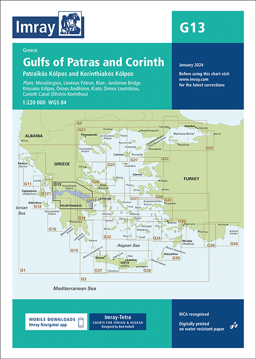
Seekarte von Imray für den Golf von Korinth zwischen Roumelien im Norden und Peleponnes im Süden.

Die Faltkarte Imray Chart G13 vom englischen Kartenhersteller Imray deckt als Seekarte den Golf von Korinth ab. Für diese Ausgabe sind die neuesten Tiefenvermessungen und Schießübungsplätze enthalten. Abgeschlossene Hafenarbeiten in Pátras, Kiato und Loutráki werden ebenfalls aufgeführt. 

Die kompakten Faltkarten von Imray geben eine Übersicht über eine bestimmte Region. Alle Karten sind auf stabiles und wasserfestes Papier gedruckt. 

  • Die Seekartenformat: 64 x 90 cm 
  • Maßstab ist 1 : 190.000.
  • Die Karten sind in dem verlagseigenen Farbbild (Wasser blau, Flachwasser weiß, Land grün) gehalten. 
  • Lieferung in durchsichtiger Plastiktasche.

Enthaltene Detailkarten:

  • Mesolóngion (1:40 000)
  • Liménas Pátron (1:12 500)
  • Ríon - Andírrion Bridge (1:30 000)
  • Órmos Aiyíou (1:15 000)
  • Krissaíos Kólpos (1:50 000)
  • Órmos Andíkiron (1:50 000)
  • Kiato (1:10 000)
  • Órmos Loutrákiou (1:20 000)
  • Corinth Canal (Dhiórix Korínthou) (1:25 000)
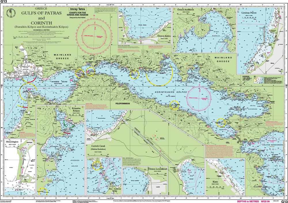

Imray Chart G 13 - preview

0 von 0 Bewertungen

Durchschnittliche Bewertung von 0 von 5 Sternen

Bewerten Sie dieses Produkt!

Teilen Sie Ihre Erfahrungen mit anderen Kunden.


Gebietsvorschau

Mit Hilfe unserer Gebietsvorschau erhalten Sie einen Eindruck davon, mit welcher geografischen Region sich das Produkt auseinandersetzt oder welche Gebiete eine Seekarte abdeckt.

Revierführer

Gebietsvorschau für Hafenguide Griechenland 1 öffnen
Hafenguide Griechenland 1
Törnführer für das Mittelmmer von Albanien bis Athen

69,90 €*
Gebietsvorschau für Hafenführer IONISCHES MEER - Griechenland, Korfu bis Korinth und Kythira öffnen
Hafenführer IONISCHES MEER - Griechenland, Korfu bis Korinth und Kythira
Spiralgebundener Hafenführer. Korfu bis Kythira und Korinth.

44,00 €*

Flaggen

-5 %
Gastlandflagge Griechenland 20X30cm
Größe: 20x30cm
Robuste und langlebige Gastlandflagge für Griechenland.

6,90 €* 7,28 €* (5.22% gespart)

Andere Kunden kauften auch

Gebietsvorschau für IMRAY CHART G3 Aegean Sea (South) öffnen
IMRAY CHART G3 Aegean Sea (South)
Aegean Sea (South)

31,90 €*
Gebietsvorschau für NV Charts Greece GR1 - Griechenland Ionische Inseln & Peloponnes - Albanien öffnen
NV Charts Greece GR1 - Griechenland Ionische Inseln & Peloponnes - Albanien
Seekarten für Albanien und die Ionischen Inseln- Montenegro bis Kap Maleas & Peloponnes

74,99 €*

Verwandte Produkte zu diesem Artikel

Gebietsvorschau für IMRAY CHART G26 Nisos Evvola öffnen
IMRAY CHART G26 Nisos Evvola
Nisos Evvoia

31,90 €*
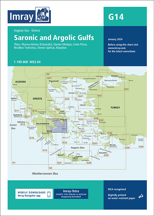
Gebietsvorschau für IMRAY CHART G14 Saronic and Argolic Gulfs öffnen
IMRAY CHART G14 Saronic and Argolic Gulfs
Saronic and Argolic Gulfs

31,90 €*
Gebietsvorschau für IMRAY CHART G25 Northern Sporades and North Évvoia öffnen
IMRAY CHART G25 Northern Sporades and North Évvoia
Northern Sporades & North Evvoia. Aegean Sea.

31,90 €*
Gebietsvorschau für IMRAY CHART G12 South Ionian Islands Nisos Levkas to Nisos Zakinthos öffnen
IMRAY CHART G12 South Ionian Islands Nisos Levkas to Nisos Zakinthos
South Ionian Islands - Nisos Levkas to Nisos Zákinthos.

31,90 €*
Gebietsvorschau für IMRAY CHART G3 Aegean Sea (South) öffnen
IMRAY CHART G3 Aegean Sea (South)
Aegean Sea (South)

31,90 €*
Gebietsvorschau für IMRAY CHART G141 Saronikós Kólpos Corinth Canal to Akra Sounion and Nisos Poros öffnen
IMRAY CHART G141 Saronikós Kólpos Corinth Canal to Akra Sounion and Nisos Poros
Saronikós Kólpos - Corinth Canal to Ákra Soúnio and Nisos Póros.

31,90 €*

Ähnliche Artikel

Gebietsvorschau für GR PC 12 öffnen
GR PC 12
Northern Dodecanisa. Diese griechische Sportbootkarten sind Seekarte und Pilot Chart in einem. Sie sind beidseitig farbig auf wasserfestem Papier gedruckt und werden gefaltet auf das Format 17 x 2...

22,00 €*
Gebietsvorschau für IMRAY CHART G27 Nísos Lésvos & the Coast of Turkey öffnen
IMRAY CHART G27 Nísos Lésvos & the Coast of Turkey
Nísos Lésvos & the Coast of Turkey

31,90 €*
Gebietsvorschau für GR G PC 2 öffnen
GR G PC 2
Ionian Pelagos (General Pilot Chart). Diese griechische Sportbootkarten sind Seekarte und Pilot Chart in einem. Sie sind beidseitig farbig auf wasserfestem Papier gedruckt und werden gefaltet auf ...

22,00 €*
Gebietsvorschau für IMRAY CHART G33 Southern Cyclades (West Sheet) öffnen
IMRAY CHART G33 Southern Cyclades (West Sheet)
Southern Cyclades (West Sheet)

31,90 €*
Gebietsvorschau für IMRAY CHART G34 Southern Cyclades (East Sheet) öffnen
IMRAY CHART G34 Southern Cyclades (East Sheet)
Southern Cyclades (East Sheet).

31,90 €*
Gebietsvorschau für IMRAY CHART M29 öffnen
IMRAY CHART M29
Golfo di Taranto. Italien, Südküste

31,90 €*
Gebietsvorschau für IMRAY CHART M30 öffnen
IMRAY CHART M30
Südliche Adria & Ionisches Meer - Dubrovnik - Kerkira & Sizilien.

31,90 €*
Gebietsvorschau für GR PC 19 öffnen
GR PC 19
N. Antipaxio to Kyparrisia. Diese griechische Sportbootkarten sind Seekarte und Pilot Chart in einem. Sie sind beidseitig farbig auf wasserfestem Papier gedruckt und werden gefaltet auf das Format...

22,00 €*
Gebietsvorschau für Greece Sea Guide IV öffnen
Greece Sea Guide IV
Islands of the North and East Aegean and Dodekanisa Islands (except Astypálaia - Syrna)

90,00 €*
Gebietsvorschau für IMRAY CHART G1 Mainland Greece and the Peloponnisos öffnen
IMRAY CHART G1 Mainland Greece and the Peloponnisos
Mainland Greece and the Peloponnisos

31,90 €*
Gebietsvorschau für IMRAY CHART G21 Northwest Aegean Sea öffnen
IMRAY CHART G21 Northwest Aegean Sea
Northwest Aegean Sea

31,90 €*
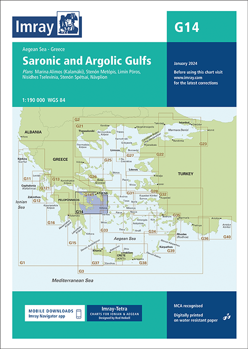
Gebietsvorschau für IMRAY CHART G14 Saronic and Argolic Gulfs öffnen
IMRAY CHART G14 Saronic and Argolic Gulfs
Saronic and Argolic Gulfs

31,90 €*